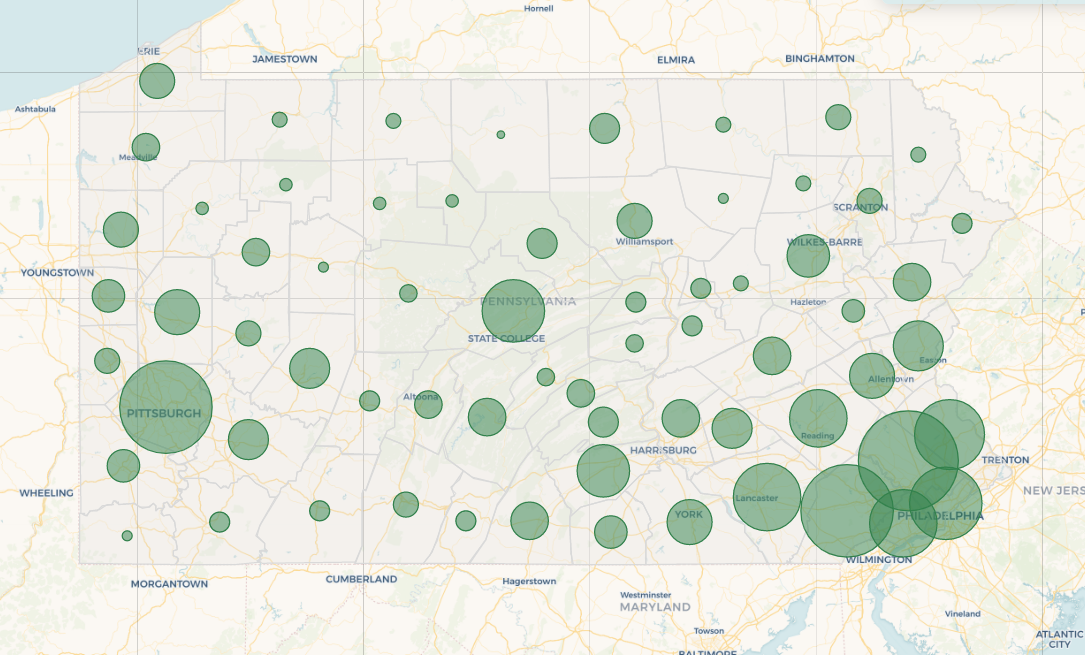
Falcons and Hawks Observed in Pennsylvania
This project maps hawk and falcon sightings in Pennsylvania and provides information and images of each species mapped.
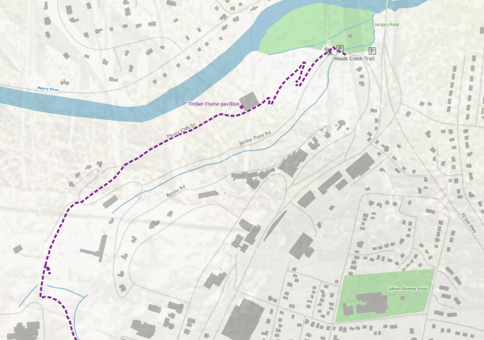
Woods Creek Trail
This map of the Woods Creek trail, a short, urban trail in Lexington, Va, highlights some of the features to see and other useful information for those interested in visiting the trail.
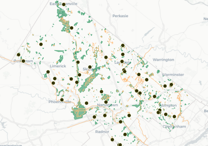
Mapping breweries near trails
This map highlights trails near breweries in Montgomery county, Pa.
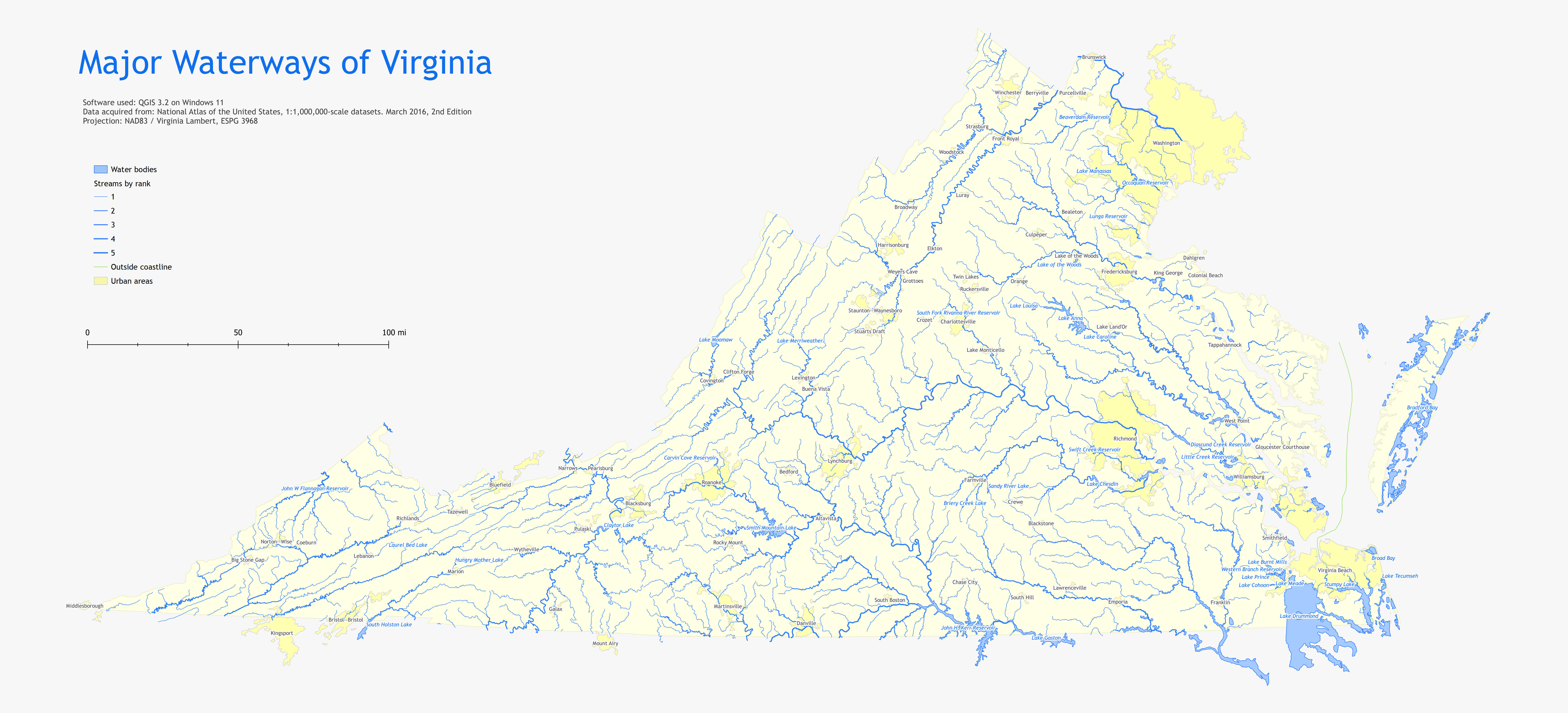
Waterways of Virginia
This map shows stream networks in Va, categorized by size. This was created as part of a lab in Maps 671 in 2022.
US Wind Turbine Density
This map shows US Wind Turbine Density based on data from the USGS.